Difference between revisions of "Bubble map"
From wiki.pengtools.com
(→Brief) |
|||
| Line 32: | Line 32: | ||
[[Category:E&P Portal]] | [[Category:E&P Portal]] | ||
[[Category:Subsurface]] | [[Category:Subsurface]] | ||
| + | [[Category:Mature Water Flood Analysis]] | ||
| + | [[Category:Reservoir Management]] | ||
Revision as of 12:29, 27 December 2017
Brief
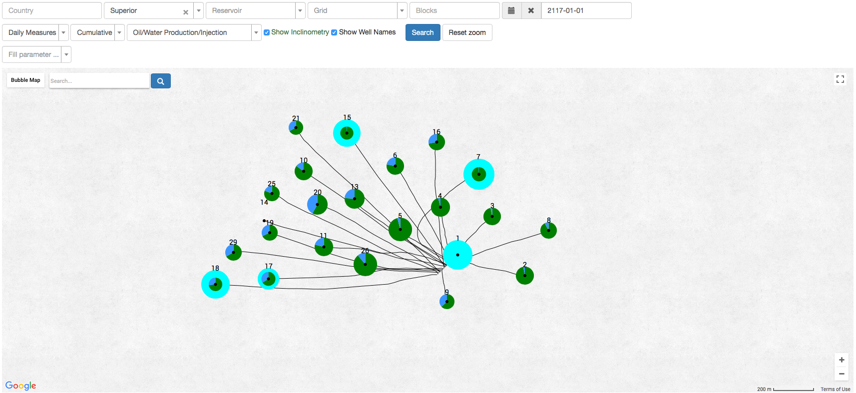
Bubble map is a representation of the Wells Daily Measures on a map.
Common Bubble map representations are cumulative oil produced or water injected, rate per well with water cut fraction etc.
Bubble map Parameters
- MD - measured depth
- TVD - true vertical depth
- TVD SS - true vertical depth sub sea
- Incl Angle
- Azimuth
- x - x coordinate
- y - y coordinate
- dx
- dy
Date Required
Bubble maps are uploaded to the E&P Portal here.

